Sights and attractions of Kyrgyzstan
Bishkek


Bishkek is the capital of Kyrgyzstan and the largest city in the country in terms of population (over one million). Bishkek is located in the center of the Chui Valley, at the foot of one of the Tian-Shan mountain ranges, the Kyrgyz Ala-Too. It is 375 kilometers long and stretches from Boom Gorge to Talas Province. The highest point of the range (4,875 meters) is the Semyonov-Tian-Shansky peak.
The people of Bishkek divide the city into two parts, the upper part and the lower part. The upper (south) part is closest to the mountains, the lower (north) part is closer to the border with Kazakhstan. The upper part of the city is considered cleaner in terms of ecology. But almost all « life » is concentrated below. This is where the main sights, markets and other sights are located.
Bishkek is a square city. There are hardly any winding streets. That’s why it’s almost impossible to get lost. The inhabitants of the city orient themselves by crossing the streets. For example, they rarely make an appointment in a simple restaurant, but prefer to add that it is at the intersection of such and such a street.
Bishkek is a very green city. There are many parks, boulevards and squares. Not far from the capital, the green mountains and the national park of Ala-Archa are very close. It covers more than 2,200 hectares and is the most popular resting place for Bishkek residents, tired of the bustle of the city.
St. Nicholas Church in Bishkek is the oldest building in the city, built in 1886. True, only the name remains of the church. The domes and crosses were removed long ago, since since 1934 the building has been used as an exhibition hall. Today there is an art gallery of the Union of Artists of Kyrgyzstan.
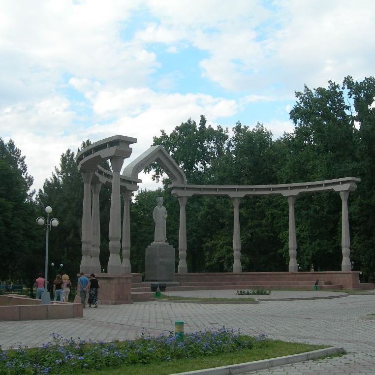
Also on Ala-Too Square is a monument to Manas the Magnificent, the hero of the popular epic Manas. This last point should be mentioned separately. The Manas Epic is included in the UNESCO Intangible Heritage List and in the Guinness Book of Records as the longest epic in the world.
The main museum in the country is the Kyrgyz State Historical Museum, which is located in Ala-Too Square. This is a traditional museum, which presents objects dating from the Stone Age and the Bronze Age, objects from the daily life of the nomadic Kyrgyz people, as well as the formation of independent Kyrgyzstan.
Ala-Archa
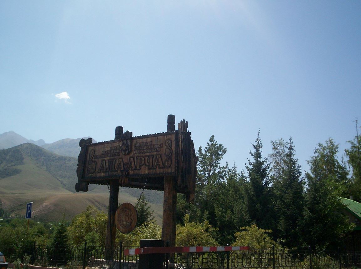


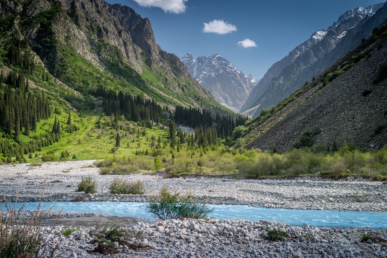
The mountainous Ala-Archa region in Kyrgyzstan is a place of staggering beauty, located some 40 km from the country’s capital – Bishkek. Unspoiled nature, the diversity of floral species and more particularly conifers, passes, glaciers, rocks, waterfalls – this is what awaits travelers who come to the Ala-Artcha National Natural Park.
The Ala-Archa national natural park (ala-archa means « variegated juniper »), with an area of 2280 hectares, was created in 1976 in the pass of the same name. The park located on the northern slope of the Kyrgyz Range at an altitude of 1600 to 4875 m, extends from the upper center of Ala-Too to the north of the Ala-Archa pass. From 1951 the region has attracted enthusiasts of active tourism – mountaineering, hiking or hiking, trekking. Nearly 150 mountaineering and tourism routes of different difficulty levels are planned, winter and summer sessions are organized.
The alpine camp « Ala-Archa », located at 2100 m above sea level, is a place of attraction for mountaineers from all over the world. The most visited places are the glacier and the Ak-Sai waterfall. It is here that the peaks Dvurogaya (« Bicorne », 4380 m), Korona (« Crown » 4860 m) and the highest point of the entire Kyrgyz ridge, Semionov-Tian-Shansky peak (4875 m) are located. Ala-Archa is rich in picturesque slopes where rock and glacier climbing training takes place. At an altitude of 3400 m is the stone hut called « Racek’s hut » (named after the famous Soviet mountaineer) where almost all mountaineers stop in search of some warmth and magnificent landscapes of the peaks that are only 1-3 hours walk from there.
Burana
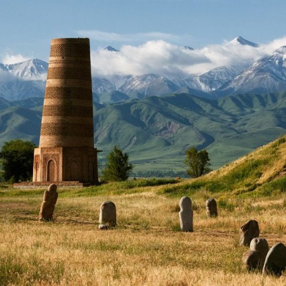


The Burana tower, located 80 km from Bishkek, is one of the best-known archaeological sites in Kyrgyzstan. Burana Tower also houses a museum of important archaeological pieces that tell the story of the Great Silk Road and Kyrgyzstan’s place on it. Burana Tower is all that remains of the city of Balasagun, which was the capital of the Karakhanid Empire in the 9th century. Around the base of the tower are several excavation sites which show the brick foundations of the buildings, although archaeologists have shown that the town extended a little further (shops, bazaars, baths and houses have all been discovered).
There is also a small collection of balbals, or kurgan steles, near the tower. These small stone figures were used to honor the dead, and sometimes marked the spot where a body was buried. They are excellent examples of stone masonry from the 6th century AD and are accompanied by petroglyphs from the 2nd century BCE which were brought here for display.
The museum itself is small, but it houses some unique and interesting items. Balasagun’s location on the Great Silk Road has made it a hub for traders, with goods and people criss-crossing the continent from east to west. Coins, pottery and other objects show the diversity of the region and its history.
Chon-Kemin natural park

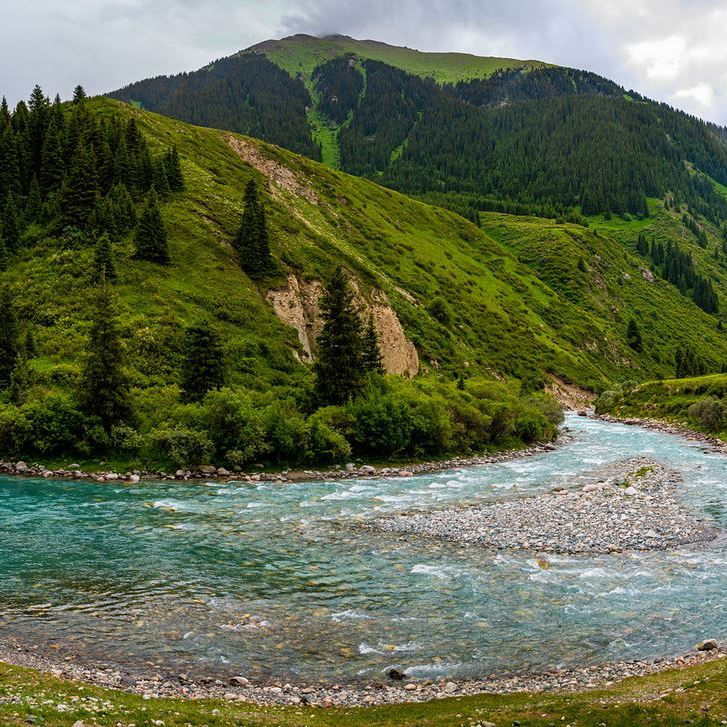
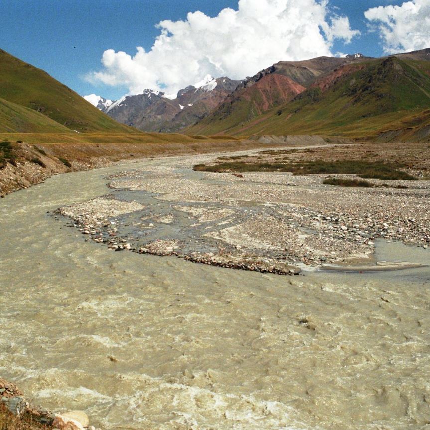

Chon-Kemin Natural Park is located 150 km from Bishkek. It is spread over 500 hectares and has an altitude between 1400 and 2800 meters. The park is revealed through one of the most picturesque landscapes of Kyrgyzstan, with its river, its lakes, a gorge and its green valley. It will undoubtedly delight nature lovers, but also extreme sports enthusiasts who can try out a few rafting sessions. In 1911, Kemin was the area that recorded the strongest earthquake in Central Asia. The strength of the tremors at the epicenter reached a magnitude of 11 on the Richter scale. The park was founded in 1997 bringing together the majority of forest farms in the Kemin district. Since then, the park has been under the protection of the Kyrgyz state.
This valley was the birthplace of the first president of Kyrgyzstan, Askar Akaev. The Chon-Kemin valley is a real wild and natural area perfect for lovers of nature and walks in the fresh air. This large nature reserve of 500 hectares, unique in the country, reveals itself with magnificent reliefs and a river which crosses it. The ecosystem there being quite special, it is home to many species of animals and plants. In particular, there are rare endemic animals such as the snow leopard, the maral (the smallest deer in Central Asia), or golden eagles. The flora also has a very wide variety of plants, herbs, berries and mushrooms to discover.
The park is very interesting for sports enthusiasts, with several possible activities such as hiking, fishing or even horseback riding. For the more adventurous, it is now possible to indulge in a rafting session, nothing better to get a good dose of adrenaline. The park is full of very little traveled trails that will lead you to a gorge or to the seven lakes of the valley’s river basin, surrounded by spruce forests.
Passes at more than 2500 meters offer a breathtaking view of the whole region, and camping becomes a real pleasure in a nature as beautiful as it is virgin. From the valley are visible the heights of the Ala-Too mountain range culminating at 4700 meters and its eternal snow. Thus, Chon-Kemin is a paradise for lovers of tourism and extreme. Torrential river, steep slopes, and green paths, everything an athlete or nature lover can dream of, is gathered in this little paradise.
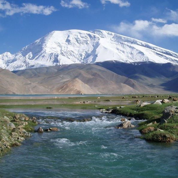
Issik-Kul lake
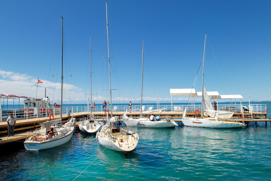


Mountain lake that never freezes Issik-Kul means in Kyrgyz a « warm » lake, which lies between the mountain plateau, having its mysterious geological history. The valley of Issik-Koul with a length of 200 km, a width of 70 km, is at a height of 1609 meters. With the depth of 700 meters, the surface of 6236 square km one of the deepest and largest lakes in the world Issik-Kul is surrounded by mountain ridges Koungei Ala-Taou in the north, Terskei Ala-Too in the south.
Issik-Kul is a unique place on the planet which is famous for its warm beaches, thermo-mineral springs, alpine glades, coniferous woods. During the day, without special preparation, you can reach the highest peak, you can ski on fresh snow, see beautiful glades, medicinal flowers, enjoy clean air, coniferous woods, swim in the pure waters of the waterfall, and warm up in the mineral springs, rest on the warm beaches of Lake Issik-Kul. For people with health problems we offer a wide range of medical treatment. There is a local mineral mud treatment area.
More than 100 rivers flow into Lake Issik-Kul, but the lake does not flow anywhere. Of a resplendent blue, the surface of Issik-Koul is clear up to a depth of 40 meters where we can still see the fish. The Issik-Kul region is a marshy place, the place of nesting and resting place of several migratory birds among which swans, geese, ducks, cranes and others.
Karakol
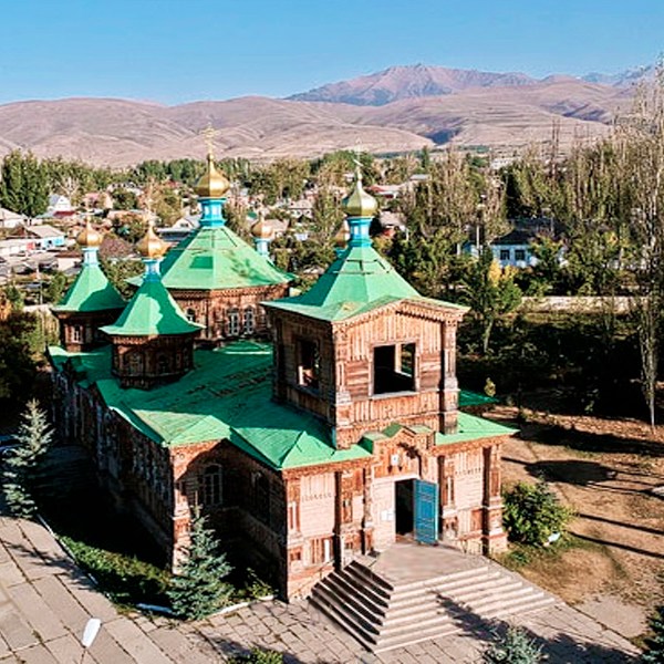


At the eastern end of Lake Issyk-Kul is Karakol, a small town of green avenues and wooden chalets. Just to the east are the Terskey Ala-Too mountains, and 10 km to the west is the shore of Lake Issyk-Kul. Karakol was founded in 1869 as a Russian garrison and grew rapidly as explorers passed through the city going deeper into the Tian-Shan. The city grew when Dungan peoples fled violence in China in the 1880s and settled in Karakol. Then, in 1888, Russian explorer Nikolai Prjevalsky died in Karakol, and the city was renamed in his honor. In 1921 Karakol regained its original name, but the decision was reversed by Stalin in 1939. In 1991 Karakol reverted to Karakol.
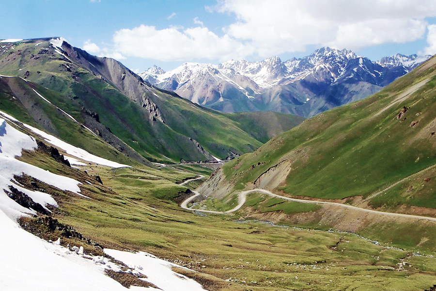
As it is located so close to so many spectacular mountains, Karakol is an excellent starting point for hikes and treks. There are treks that depart from Karakol to suit any adventurer, from day hikes to longer treks. The surrounding mountains are among the most spectacular in Kyrgyzstan, with hidden lakes, wide glaciers and the country’s two highest peaks, Pobeda Peak (7439m) and Khan Tengri (7010m). The two most popular destinations near Karakol are Altyn Arachan and Jeti Oguz, both of which are great for hiking or picnicking.
The cattle market is popular among visitors who want to experience a traditional Kyrgyz bazaar. Karakol also has a Dungan Mosque and an Orthodox Church, both testaments to the region’s diversity and history (and don’t forget to visit the many delicious restaurants around Karakol and sample some local delicacies). There are also several museums in Karakol including a museum dedicated to the scientist Prjevalsky.
Kochkor


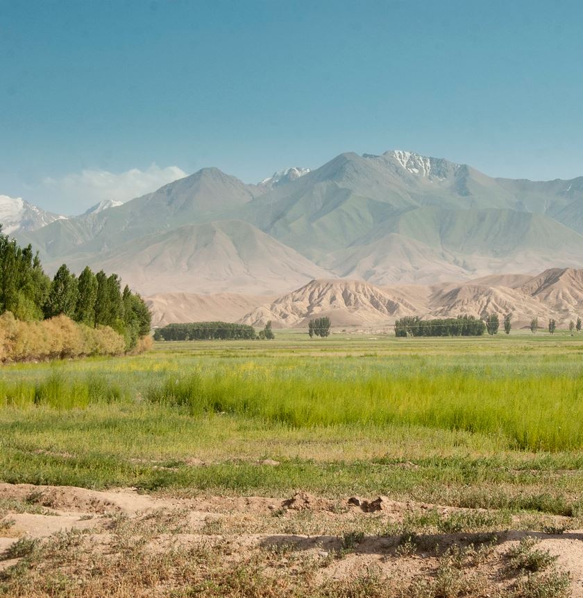
Kochkor is located in Naryn province, on the road to Son-Kul Lake and Torugart Pass. Kochkor was once a stopover for merchants coming and going from Kashgar across the Torugart Pass in China. Today, Kochkor has become a stopover for tourists heading for Tian-Shan.
Kochkor has been relatively well developed in terms of tourist infrastructure. Transport, hikes, horseback riding, family stays and concerts are all relatively easy to organize. Kochkor is now home to craftsmen who specialize in traditional Kyrgyz art, reviving the region’s traditions and making lasting memories. Kochkor has become famous for its shyrdaks and felt rugs which are made in workshops in the city. Tourists can also learn how these rugs are made through demonstrations by the masters themselves, and those wishing to immerse themselves in Kyrgyz culture can arrange homestays and concerts of traditional Kyrgyz music.
Son-Kul lake


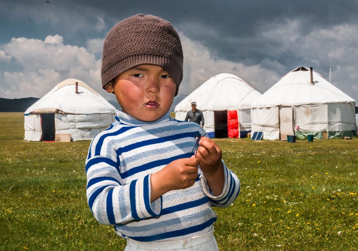

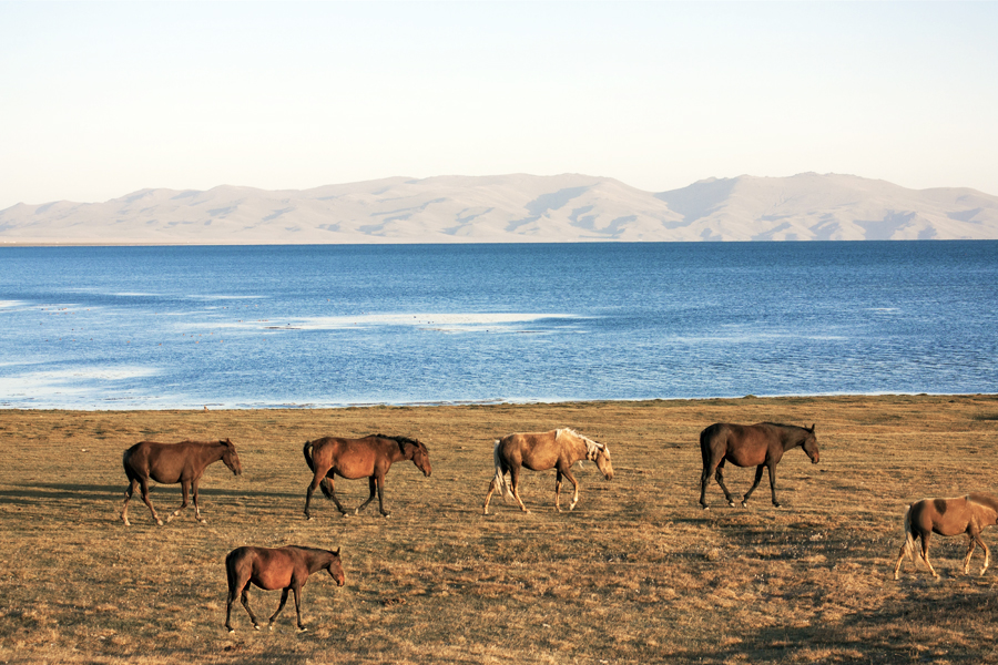
Son-Kul is one of the most famous alpine lakes and mountain meadows of Kyrgyzstan. At an altitude of 3016 m above sea level, Son-Kul is a stunning blue lake, surrounded by vast fertile meadows that have long been used by nomadic herders for their animals. Son-Kul is only accessible in summer (around June to early September) because snow and ice block the road the rest of the year. There are a number of yurt camps where visitors can stay to experience traditional nomadic culture, and the surrounding mountains are ideal for horseback riding or hiking. Located about 100 km from Kochkor and 300 km from Bishkek, the road to Son-Kul takes about 6-7 hours, and although it is mostly paved, some parts are gravel.
In winter, temperatures at Son-Kul Lake can reach as low as -20°C, and there are about 200 snow days a year. During this period, the shepherds stay in nearby towns like Kochkor, At-Bashi and Naryn, where there are more protected areas for the herds during the long winter. This means that no one lives around Son-Kul in winter, and the lake itself is virtually inaccessible. When the ice of Son-Kul melts in late spring, the herds and their owners go to the vast and rich pastures that surround the lake. There are no permanent buildings around Son-Kul, only yurts, so people live the same way they have for centuries.
In summer, Son-Kul is still relatively cold due to the high altitude, with average temperatures of only 11°C, and dropping below freezing at night. Yurts are often equipped with small stoves that can heat up at night, but there is no electricity or running water in the jailoo. This makes Son-Koul a preferred destination for those who want to live like a nomad for a few days. The yurts are filled with thick mattresses (but not typical Western beds) and blankets, and there are outhouses not far from the yurt camps, which are specially organized for visitors, and there are also the shepherds’ yurts locals who live in Son-Kul. Although many locals are friendly and welcoming, it’s best to coordinate your visit ahead of time to ensure you have somewhere to stay and food to eat.
The area around Son-Kul is also a rich ecosystem, with wetlands and mountains right next to each other. There are no trees on the high plains around the lake, but there are plenty of herbs and plants that are used for their medicinal properties. Many birds, including hawks and golden eagles, live around Son-Kul, and the mountains are home to deer, foxes, Marco Polo sheep, leopards and wolves (although these animals tend to stay high in mountains). The mountains around Son-Kul are popular for hiking and horseback riding, and long and short treks can be arranged from the lakeside yurt camps.
