“The world is the sea. Would you like to swim? « Build a ship of good deeds. » (Tajik poet, singer and scholar, founder of Persian literature Rudaki, 860-941).
City of Dushanbe

The name « Dushanbe » first appears in the 7th century. Nevertheless, archaeologists believe that the history of Dushanbe dates back to the era of the Kushan Kingdom (II-III centuries AD). This is indicated by exhibits in the National Museum in Dushanbe. The capital of the Republic of Tajikistan – the city of Dushanbe is located in the Gisar Valley. Among the capitals of the Central Asian republics, Dushanbe is a young city. At the beginning of the last century, three small villages were located on its territory. The largest of them was called Dushanbe, which means « Monday ». It was named so because the bazaar used to gather here on this day of the week. Merchants who came here stopped in the neighboring villages of Shahmansur and Sary-Assia. On the site of these three villages, the capital of Tajikistan grew. In 1925, the city began to grow. Only a year later, the first company appeared here, but new buildings were already appearing everywhere, and very soon the villages located there dissolved into the greenery of the new city being built. The capital was built quickly, mainly by people who came here. In 1939 the city had 83,000 inhabitants of many nationalities, and in the second half of the last century its population reached 335,000.

Dushanbe is not only the capital, but also the most important industrial, scientific and cultural center of the republic. Along with the growth of industry, science, education and art developed. The capital Dushanbe is a city of students, a city of young people. There are many specialized secondary schools in Dushanbe. The Tajik Academy of Sciences is located in the capital. It has come a long scientific and organizational path (since 1932 it has been a base of the USSR Academy of Sciences). The Academy of Sciences brings together dozens of research institutes and laboratories, concentrated in five departments. The Institute of Seismology develops methods of constructing buildings capable of withstanding strong earthquakes. The oldest theaters of Tajikistan operate in Dushanbe: the Opera and Ballet Theater named after Sadriddin Aini, the Drama Theater named after Lakhuti, the Drama Theater. The city’s museums are interesting. A new building in the style of oriental architecture was erected on Aini Square – the United Museum of the Republic. Its exhibits tell about the nature of the republic, the history of the Tajik people, the development of the economy. It also introduces visitors to the art schools of Europe and Asia. There is a television center in the capital, the programs of which are watched not only in the city itself, but also in the towns and villages of southern Tajikistan.

Dushanbe is growing and developing rapidly. Capital investments for the development of infrastructure, hotels, tourism and services are increasing every year. Initially, the city was founded on the high, flat part of the left bank of the Varzob River. Later, the city limits expanded considerably, mainly to the south and west (on the right bank). Dushanbe is essentially a one-story city. Residential buildings of four to seven floors, buildings of universities and various institutions are found on the main streets and less often on the outskirts. The architectural appearance of Dushanbe is characterized by the predominance of different styles. Preserved buildings erected in the 1930s under the influence of constructivism. But there are more houses built in the post-war period and featuring national motifs: houses with columns, oval or lancet arches, high reliefs, statues and other decorations. The squares and parks of the sunny capital of Tajikistan are interesting. In the center of it is a large green square. It is especially beautiful in spring, when the bright rays of the southern sun sparkle like a rainbow in the slightest splashes of tall fountains. Opposite the square stands the building of the Opera and Ballet Theater named after Sadriddin Aini, decorated with columns. The town square is also attractive. The landscapes of Dushanbe are magnificent.

The Dushanbinka river divides the city into east and west. On the northeast side it is bordered by hills, once barren and boring, now trees and shrubs grow there. Behind the hills is the blue mass of the Gissar Range with a dark gap that goes deep into the mountains of the Varzob gorge. The mountains create a kind of microclimate in Dushanbe. Light summer breezes blow over the city all the time. During the day they blow towards the mountains, and in the evening and at night from the mountains. Therefore, even in July, when the ground warms up to 40-50°, coolness sets in immediately after sunset. And the locals don’t suffer so much from congestion. Dushanbe is magnificent not only with the magnificence of the surrounding mountains and lush gardens. It is beautiful, first of all, with wide straight streets which divide it into regular squares of quarters, framed by white acacias, maples, poplars, plane trees. These streets cannot even be called alleys, because the intertwined foliage on the asphalt turns many of them into a kind of tunnels that almost do not let in the hot rays of the sun. Many lawns delight with an abundance of flowers. There are several parks in the city. Magnificent botanical garden. The zoo presents animals and birds from different continents of the globe. In the right bank part, where there was a wasteland scorched by the sun, an artificial lake appeared with beaches, sports and boat stations, where townspeople rest until late autumn.
Kalai-Khumb
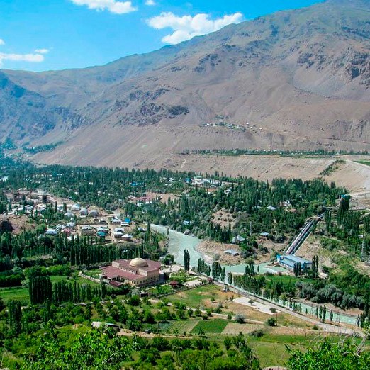
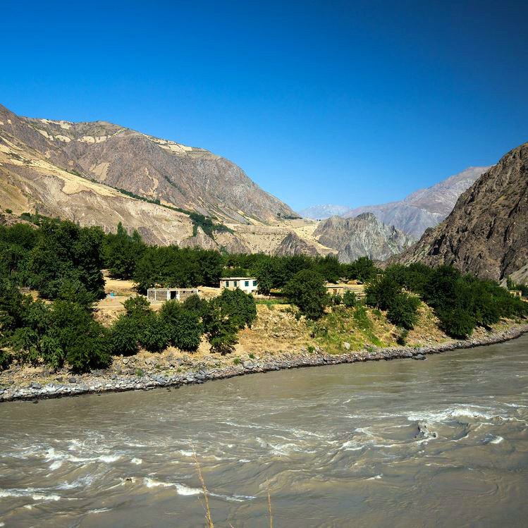


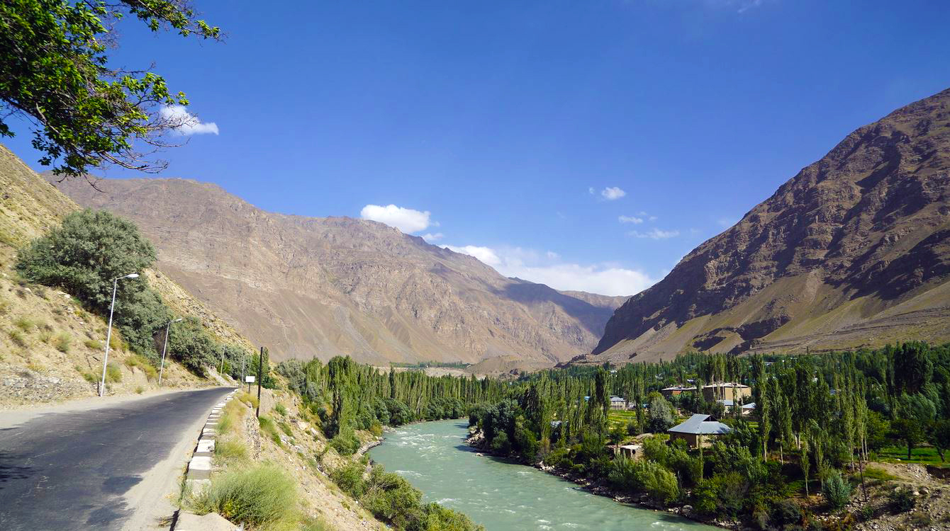
Kalai-Khumb is a small village on the Pyanj river and one of the first sites on the road along the Pamir Highway after Dushanbe. The unusual name of this site translates from Persian as « Fortress on Khoumba » – the Obikhumboi River flows here, which flows into the Pyanj. Also, Kalai-Khumb is the administrative center of the Darwaz region in the Gorno-Badakhshan Autonomous Region.
The history of Kalai-Khumb began in the 15th century, when a fortress was built here. At first it was an outpost on the border of the Pamirs, protecting the eastern outskirts of the Timurid empire. Later, Kalai-Khumb became the capital of the independent Darwaz khanate, which existed until the end of the 19th century. For a time it was part of the Bukhara khanate, and with the advent of Soviet power it became a regional center in the Gorno-Badakhshan region, part of the Tajik SSR.
The last significant event in the history of Kalai-Khumb was the Afghan war of 1979-1989, when one of the crossings of Soviet troops to Afghanistan was organized here. Kalai-Khumb is located right on the border with Afghanistan, and one of the three bridges over the Pyanj river is located nearby. A traditional bazaar was periodically held near this bridge, when merchants arrived from Afghanistan, but recently such bazaars have not been held in Kalai-Khumb.
Today Kalai-Khumb is a quiet and cozy town with a population of 1600, where you can find several guesthouses or stay at the luxurious Karvon Palace hotel. Located at an altitude of 1200 meters, Kalai-Khumb enjoys a pleasant climate for a region as harsh as the Pamirs. Therefore, travelers traveling along the Pamir Highway from Dushanbe usually make their first stop here.
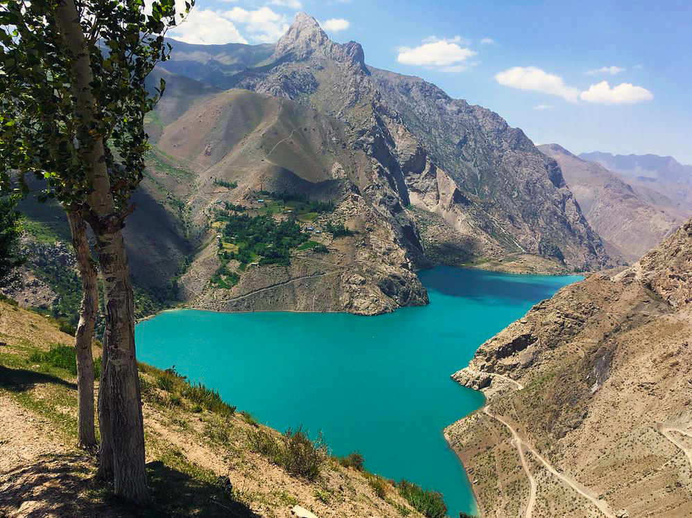
Iskanderkul


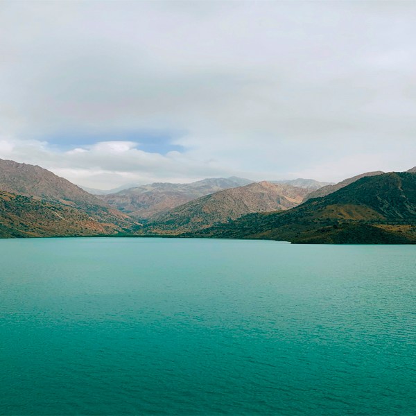
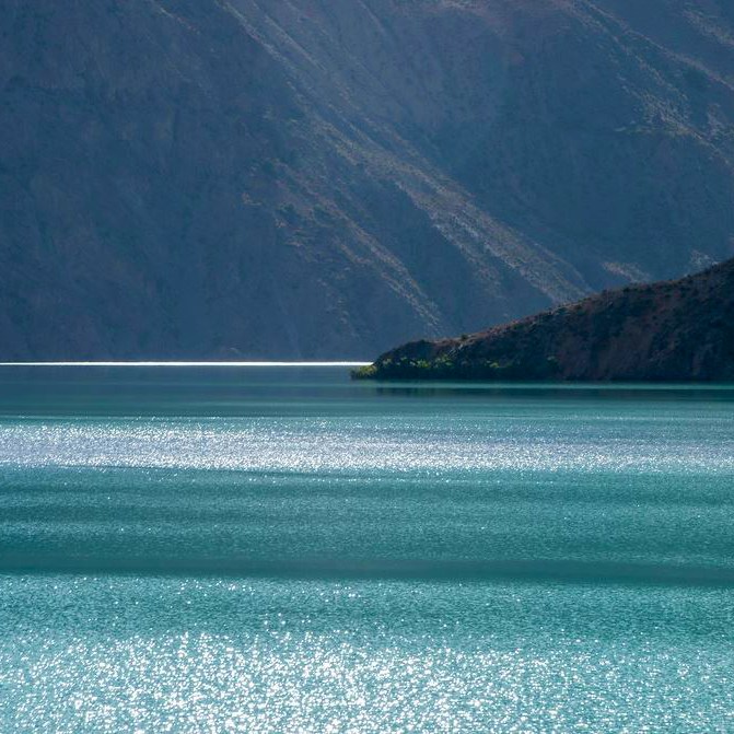
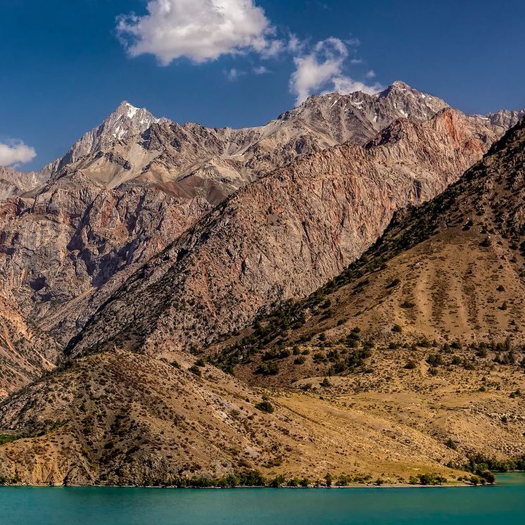
Iskanderkul lake is one of the visiting cards of Tajikistan. Visiting Tajikistan, but not going to Iskanderkul Lake, is like visiting Paris for the first time, but not climbing the Eiffel Tower. Moreover, getting to this popular attraction is not so difficult – between Dushanbe and Lake Iskanderkul it is only 130 km. The name of Lake Iskanderkul comes from « Iskander » – that’s how Alexander the Great was called in the East, and « kul » – which means lake in the local languages. In other words, it is the lake of Alexander the Great. It is not known for certain whether the famous commander was here, but several legends about the lake are associated with his name.
According to a legend, during a campaign against Sogdiana and Bactria, Alexander the Great encountered resistance from a mountain village, which resolutely did not want to submit to the great conqueror. And then Alexander ordered to change the channels of the rivers in order to flood the recalcitrant, and this is how Lake Iskanderkul was formed. According to another legend, during his conquests, Alexander the Great stopped for a halt on the shore of the lake, and his beloved horse Bucephalus caught a cold after drinking the ice water of Iskanderkul. When he recovered, he scaled a high rock and jumped into the water. Alexander waited several days and, leaving the grooms by the lake, he led his army. And since then, on a full moon on Iskanderkul, you can see a snow-white horse coming out of the water to graze on the picturesque shore.
If you look at Iskanderkul from a scientific point of view, it is a dam-like lake, which was formed after the rock collapsed. It is located at an altitude of 2195 meters above sea level, having a depth of 72 meters and an area of 3.4 km². You can swim there, and many tourists relax on the rocky beaches in the summer, but already 10 meters from the shore the water temperature drops sharply to about + 10 ° C. Moreover, in addition to Lake Iskanderkul itself- even there are several other attractions: Serpent Lake due to the higher water temperature it is inhabited by many snakes; 43-meter waterfall « Fanskaya Niagara », located on the flowing river of Iskanderkul; and a rock with the inscription « Russians, 1870 », left by the expedition of the famous scientist and traveler Alexei Fedchenko. For the sake of Iskanderkul, it is worth spending a day on a trip here from Dushanbe, and memories of this beautiful lake will remain for a lifetime!
Khorog
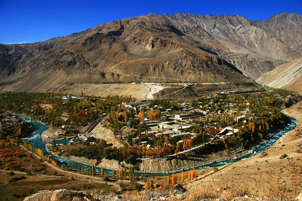
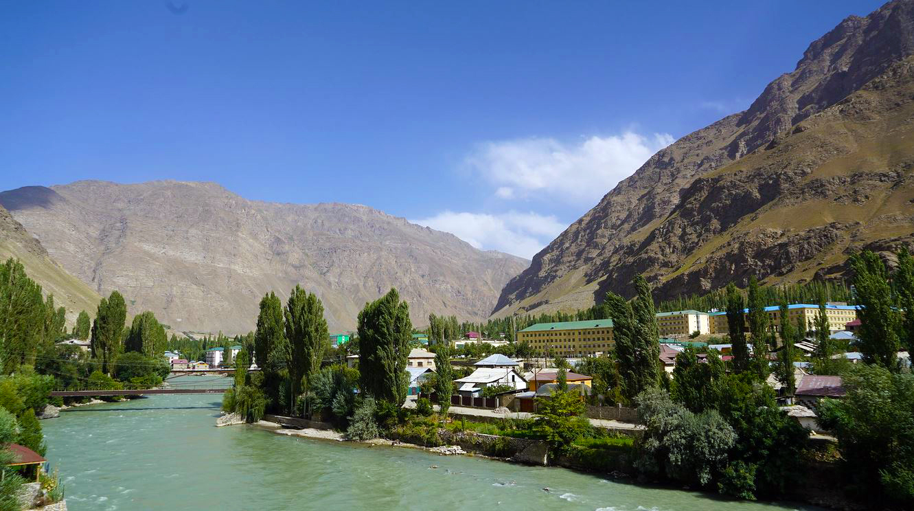
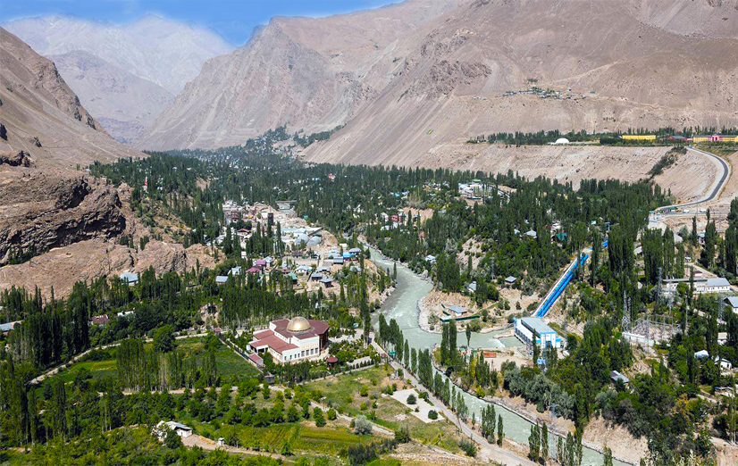

Khorog is the administrative center of the Gorno-Badakhshan region and the only city in the Pamirs. It is located approximately in the middle of the Pamir route: 600 km from Dushanbe and 730 km from Osh in Kyrgyzstan. At Khorog, the Pamir Road forks: the northern road crosses a deep mountain gorge to Murghab, and the southern one leads to the Wakhan Corridor, the most scenic part of the way, where historical monuments and colorful villages have been preserved. Thus, Khorog is the tourist center of the Pamirs, through which all roads must pass. It is located at an altitude of 2200 meters above sea level, and is one of the highest cities in the post-Soviet space and the highest city in Tajikistan.
The history of Khorog does not know the exact beginning. Once upon a time in this region there was a small state of Chungan, consisting of many fortresses scattered in the surrounding mountains, and one of them called Kalai-Panjbar was located at the confluence of the Gunt and Pyanj rivers, just at the location of present-day Khorog. At first it was an independent mountainous state, then in the XIX century it fell under the control of the Bukhara khanate, and already in 1896 the troops of Tsarist Russia appeared here. During the « Great Game » between Russia and England, the Russians sought to take control of the Pamirs, and built a road from Osh to Sary-Tash, then to Murgab, and finally to Khorog. A border post was organized on the banks of the Pyanj river, and the small village of Khorog gradually began to ennoble itself with new stone buildings. With the advent of Soviet power at the beginning of the 20th century, Khorog became the administrative center of the formed Gorno-Badakhshan autonomy and already in 1928 received city status.
Throughout the 20th century it was a commercial hub on the Pamir Highway and remains so to this day. Today Khorog is the real center of Gorno-Badakhshan. A trade route from China to Central Asia crosses it, and it is also an essential point on the tourist routes of the Pamirs. 30,000 people live here, most of whom are Pamirs who profess Ismaili (one of the Shia offshoots of Islam). At the same time, Khorog is distinguished by its level of education – there are three educational institutions in such a small town: Khorog State University, a branch of the International University of Central Asia and the Aga Khan Foundation High School. The tourist infrastructure is also gradually developing – there are several hotels and guesthouses, restaurants, internet cafes and more. Khorog’s most famous landmark is the Pamir Botanical Garden. It was founded in 1940 to test the survival of various plants in mountain climates. According to official data, more than 30,000 varieties of plants have been tried here, and therefore the collection of the garden today includes about 4,000 species of plants. The Pamir Botanical Garden is located near Khorog, and from there you can enjoy an excellent panoramic view of the whole city. Another no less popular, but rather interesting attraction of Khorog is the local history museum, which can tell its guests a lot about the nature, history and culture of Gorno-Badakhshan. The most interesting exhibit of this museum is the piano, which in 1914 was carried from Osh on their shoulders for more than a month by soldiers. To understand the complexity of this operation, it is enough to say that the path from Osh to Khorog is more than 700 km, and on the way you have to overcome several passes with a height of more than 4000 meters. Then the piano was delivered to the daughter of the commander of the border post, and all the inhabitants came to listen to the part on an instrument never seen before.
Today Khorog is the capital of Gorno-Badakhshan. Surrounded by steep high mountains, Khorog is protected from strong winds and frosts. The city looks like a green oasis against the backdrop of lifeless stone ridges. And therefore, the weather is good here almost all year round, the winters are mild, and the summers are not hot. Traveling along the Pamir Highway, Khorog will be able to tell a lot about the past and the future of the region.
Penjikent


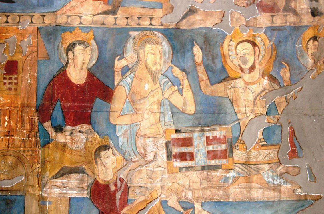
The name of the city of Penjikent, located in the Khujand region of Tajikistan, in the picturesque valley of the Zeravshan River, translates as « five villages ». It is likely that the history of this wonderful city, which dates back to the 5th – 8th centuries, began with five sites. Penjikent was then one of the most important cultural and craft centers of Sogd. It was even called « Pompeii of Central Asia ». It was a beautifully fortified and well-organized city with a ruler’s palace, two temples, markets, rich dwellings of the townspeople, decorated with numerous murals, wooden and clay sculptures of the ancient gods.
Penjikent was the last town on the way from Samarkand to the mountains of Kuhistan. It was very beneficial, because not a single caravan, not a single person, descending from the mountains to Samarkand and returning, could bypass Penjikent. The city was destroyed by the Arabs in the 8th century (the decisive battle took place on Mount Mug). The ruins of this ancient city were only accidentally discovered in the last century. Today, tourists can see here the ruins of residential buildings and administrative buildings, a citadel with a palace, a house of craftsmen and a church of fire worshipers.
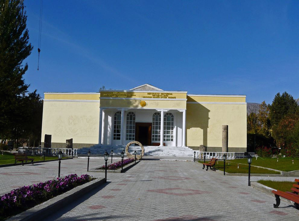
On the outskirts of Penjikent, a « piece » of the past has been preserved: an ancient city with a medieval citadel surrounded by residential and public buildings, some of which have preserved wall paintings. Nearby is a necropolis. The clay and wooden sculptures found during the excavations are preserved in the Museum of local traditions, bearing the name of Rudaki. A museum-reserve has been created on the excavation site. Not far from Penjikent, on Mount Mug, an archive of documents of the ruler of Penjikent written in the Sogdian language was found. The deciphering of these documents makes it possible to judge the social, economic and political life of the population of Central Asia in the 8th century.
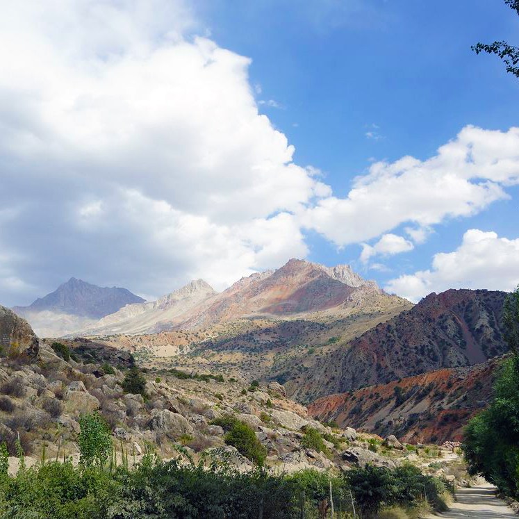
Fansky mountains


The Fansky mountains are perhaps the most picturesque mountain system not only in Tajikistan, but in all of Central Asia. This is where the greatest number of mountain hikes take place, and the variety of routes allows beginners and professionals alike to find a suitable circuit, take an easy hike through flowery gorges or conquer harsh snow-capped peaks.
The popularity of the Fansky Mountains is due not only to the beauty of the local landscapes, but also to the excellent climate. During the year, only 250 mm of precipitation falls here, and due to the average heights, the air temperature in summer does not exceed + 30 °C. The best time for hiking and climbing is July-September.
The Fansky mountains are located in the western part of Tajikistan and include parts of the Gisar and Zeravshan ranges. There are nine peaks over 5000 meters high, of which the highest Chimtarga is 5489 meters. In the Fansky mountains is the pearl of all Tajikistan – the mountain lake Iskanderkul. And also, the famous « Seven Lakes » are also located here, which cascade down a huge gorge. Russian bard Yuri Vizbor once visited here and later wrote a song with the words « I left my heart in the Fansky mountains. » Now, heartless, I walk the plains. » And everyone who rested in Fansky stands in solidarity with him.
