Sights and attractions of Turkmenistan
Ashgabat
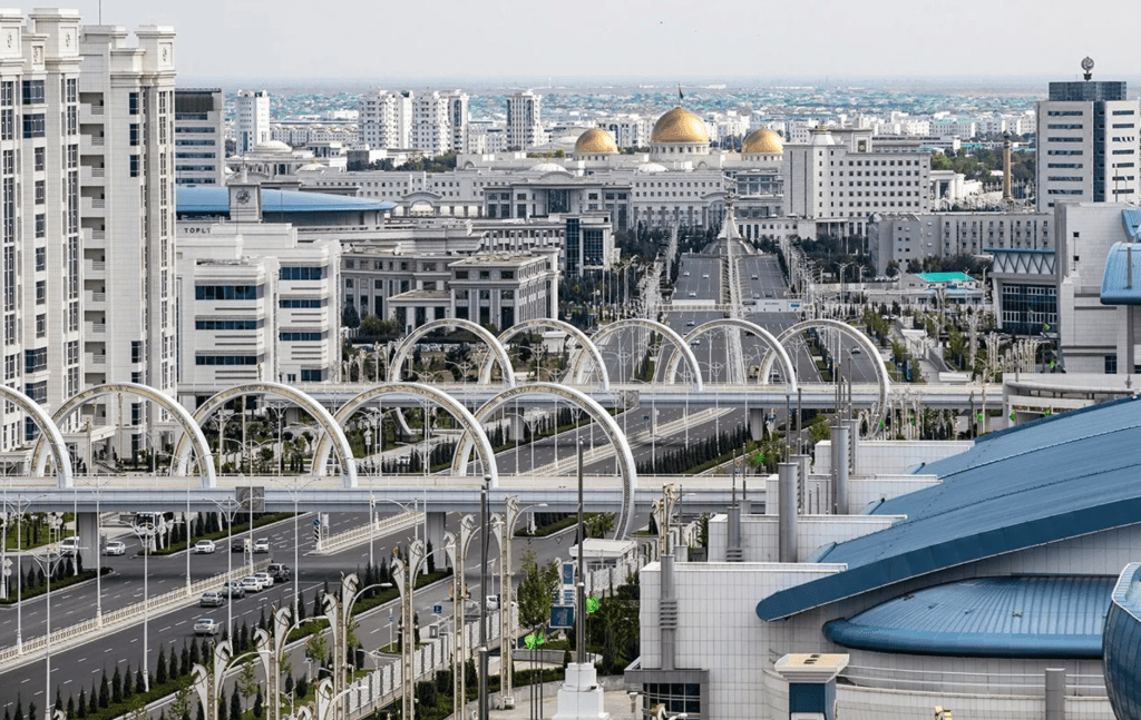
Ashgabat – is the capital of Turkmenistan, its main city. Ashghabat is located in the picturesque valley at the foothills of Kopetdagger. It appeared in 1881 as a military reinforcement not far from the homonymous village. In 1885 the railway passed here then around strengthening the city settlement began to develop. The most vivid page in the history of Ashgabat is the fall of the Geok-Tepe fortress during the colonial period of conquest by Russia. Until 1919 the city was known as Askhabad. In 1921 it was renamed to Poltorack. In 1927 the city was given an old name in a new transcription Ashkhabad (“the city of love”).
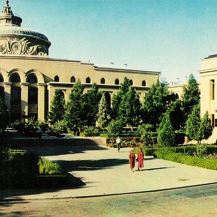
During the 90s there was another transcription – Ashgabat. Thanks to the comfortable geographical position the city has become an important trading and forwarding point. In 1948 the city experienced a powerful earthquake and was completely destroyed. Only according to official sources about 110 thousand inhabitants of the capital died, and for five years the city was closed for visitors. Volunteers from all the republics of the Soviet Union helped the people of Turkmenistan restore their capital. In a few years a beautiful new city arose in place of the ruins. But in this city there were no historical monuments. Today it is an administrative, political, scientific and cultural center. The industry is well developed. There is a university, institutes, research centers, theaters, museums and clubs.
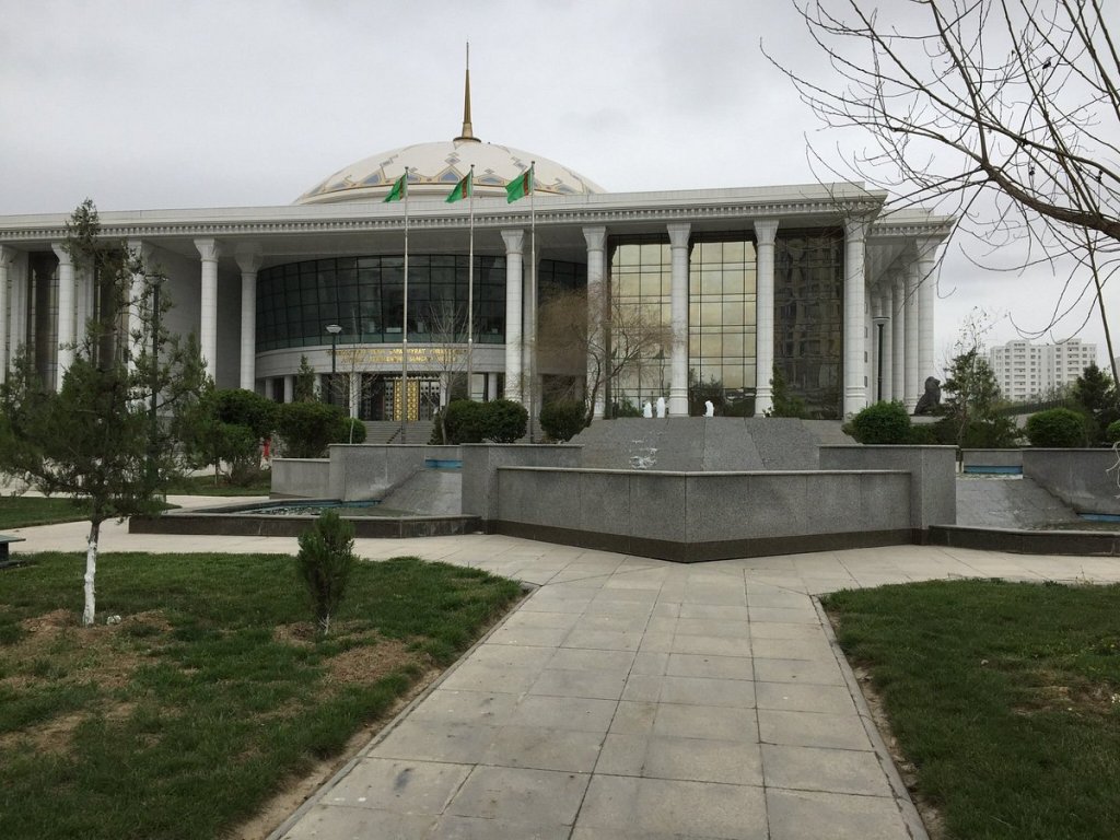
In the halls of the new National Museum, built after gaining independence, the most valuable archaeological finds testifying to the ancient history of Turkmenistan are well represented. In the fund of the museum there are dozens of monuments of traditional craftsmanship and national art of the 17th and 19th centuries. Weaving, embroidery, ceramics, carpet weaving, jewelers’ products are in the incomplete list of objects in the museum’s collection. In total at the exhibition there are more than 2500 pieces.
The Carpet Capital museum is considered a kind of unique museum in the world. We collect here a few hundred of the best models of carpets of all time, among which the oldest dates from the 17th century. The largest carpet in the world, the area of which is almost 400 m² and its weight is more than one ton is in this museum.
The exposition of the National museum of history and ethnography is no less interesting. It possesses a luxurious collection of ancient coins collected from all territory of Turkmenistan, including finds found at excavations of old Nisa.


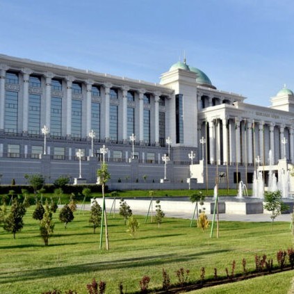
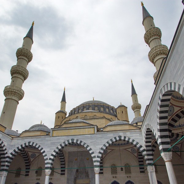


The main sights of the city are the Arch of Neutrality (from 1998, the height of which is 75 meters is the highest construction in Turkmenistan) with the golden statue of Turkmenbashi on the top, the presidential palace, the building of the Medjlis, the complex of the Academy of Sciences, the academic theater of the drama named after Mollanepes, the Bairam-khan monument, Lenin Square, the Mekan Palace, the conservatory, the orthodox church of Alexander Nevsky (XIXs ), the Ertogruulgazi mosque with four minarets and the huge dome.
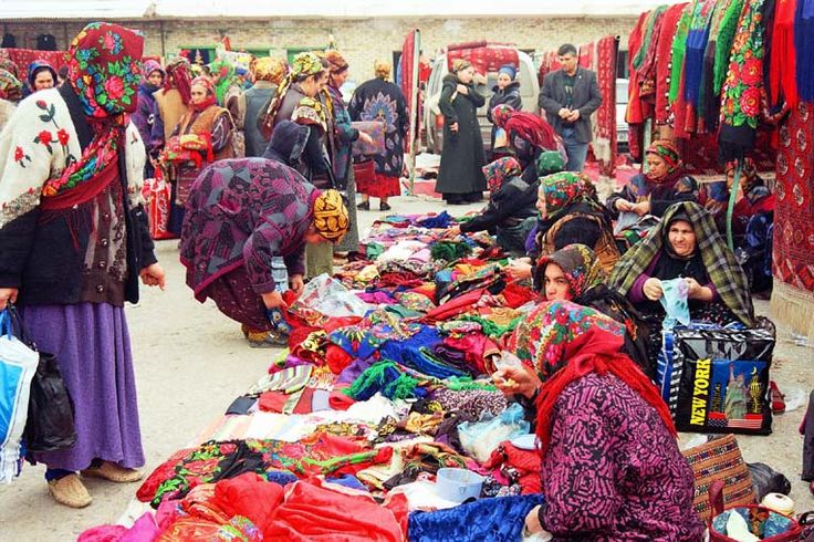
The main center that attracts tourists is the huge Sunday market « Tolkuchka », which is famous for the variety of goods and vivid Turkmen traditions. Stretching for a few kilometers along the deserted suburbs of the city, the market attracts attention, first of all, by the possibility of buying traditional Turkmen carpets, which are brought from all over the country.
Near Ashgabat there are ruins of Nisa, the capital of ancient Parthia, attracting tourists, as well as archaeologists and historians from all over the world.
Merv

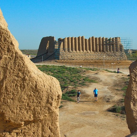
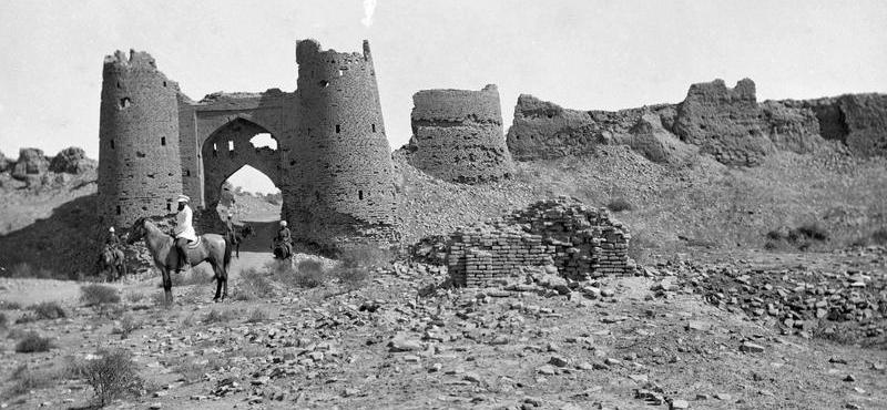
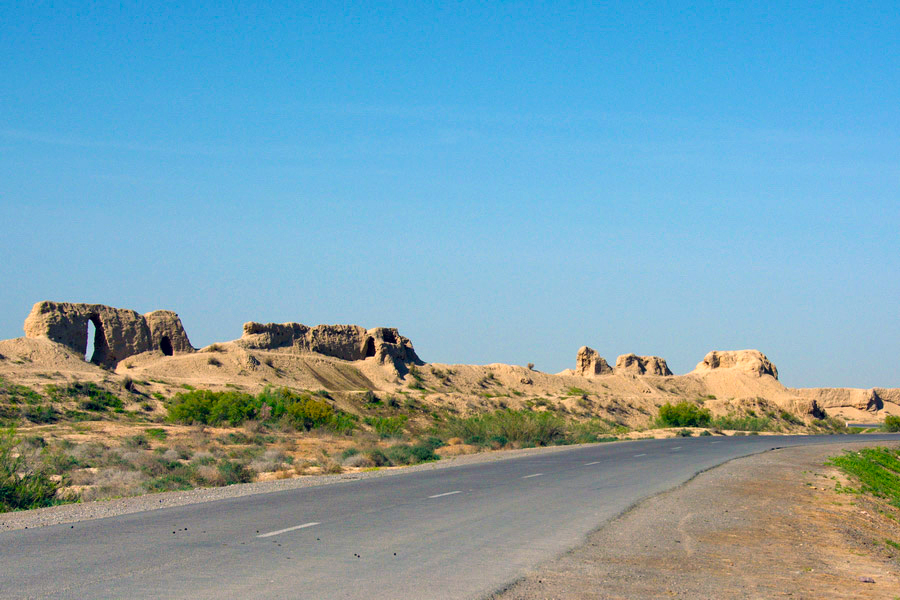
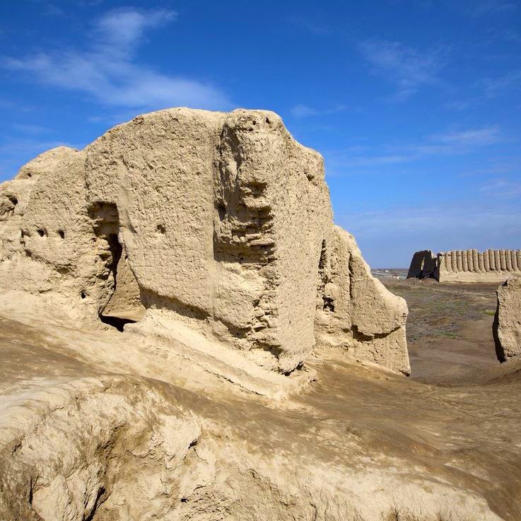
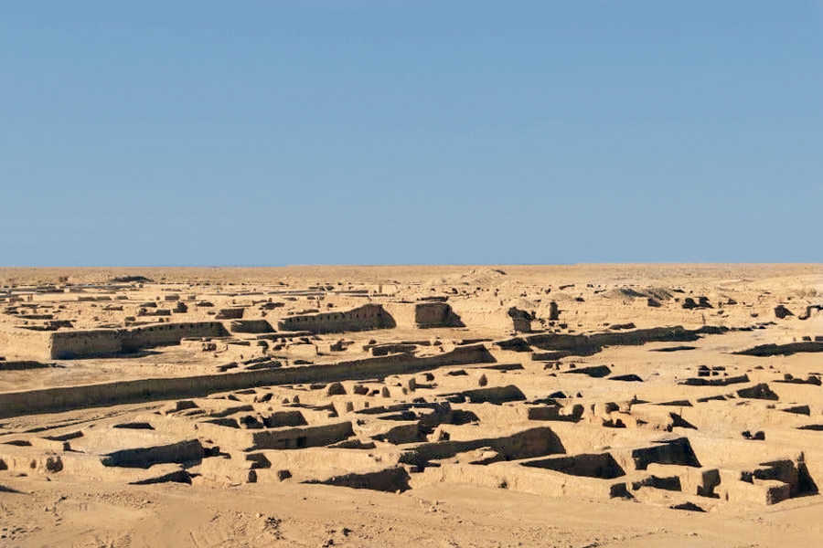
40 km from the city of Mary, near the small town of Bayramali, there are the ruins of the oldest and world famous city of Merv. She had some names in the past like: Margushe, Margilana, Mary. Merv was the capital of the prosperous region of Margiana and the most important node on a Great Silk Road long before J.-C. Merv is a true dream of the travelers fond of an ancient culture and disappearing civilizations. Today this territory contains the remains of five ancient cities from various periods. Unfortunately, the great part of buildings and constructions is destroyed. We can learn their greatness only from textbooks of history or oriental literature. For example, in « One Thousand and One Nights » Merv is mentioned as the administrative and intellectual center of the Arab Caliphate.
In 1221 after the barbarian attack of Genghis-khan’s troops, Merv was annihilated. Its ruins became the sacred thing and they received the name Ancient Merv or Old Merv. The notion « New Merv » appears for the first time at the beginning of the 15th century. It is connected with the name of the son of Tamerlane – Shahrukh. He decides to breathe life into these lands and build a new city. In 1407-1409 in the south of Old Merv, Shahrukh laid the foundation of New Merv and in almost ten years a big city appeared with palaces, buildings and fortresses. Today the ruins of Merv include several cities: Erk-Kala the Gyaur-Kala, Iskander-Kala, Shahriar-Kala, Sultan-Kala, little Sultan-Kala, Abdullakhan-Kala, Bayramalikhan-Kala.
Mary


Mary is the third largest city in Turkmenistan. It is located in a large oasis in the middle of the Karakum desert. Mary was founded in 1884 as the Russian military-administrative center 30 kilometers from ancient Merv. Now it is the biggest center of the cotton field, a big transport node and the main center of the gas industry of the country which is the main source of income of Turkmenistan. The city history museum attracts visitors with the vast collection of archaeological finds, Turkmen carpets, national dresses and silver.
Some cities which were the capitals of ancient Merv during different millennia, make the historical-architectural forbidden zone “Bayramali” which is under state protection. Among them there are monuments: Sultan-Kala (IX and XII centuries), Gyaur-Kala (III century BC, VIII and IX centuries AD), Erk-Kala (1 century BC) , Abdullakhan-Kala (15th century) and the Bayramalikhan-Kala (18th century). The main sight of Merv is the mausoleum of Sultan Sanjar (1118-1157).
Abdullakhan-Kala

The Abdullakhan-Kala fortress is connected with the name of the son of Great Conqueror Tamerlane – Shahrukh. It was one of his first constructions in the territory of New Merv. It was completed in the shortest possible time. The fortress was built by raw bricks, the internal space was handed over from small new square bricks. The walls were created with the steps. 44 watchtowers in folded form crowned the fortress. The ramparts surrounded huge (up to 30 m wide) and very deep (up to 8 m) ditches, filled with water. All of this proves that Abdullakhan-Kala had significant strategic significance and was technically well thought out. Holes were made for shooting guns, galleries and other protective means. All of this made the Abdullakhan-Kala Fortress very strong.
Akuyli-Kuchuk

2 km from the city of Durnali the ruins of the medieval palace Akuyli-Kuchuk remained. It is one of the well-kept castles of that time. The dwellings on the ground floor are almost all intact, those on the first floor are half destroyed. The palace is rectangular in shape, made of raw earth. The exterior walls of the first floor are embossed. In the center of the palace there is the square hall, the height of which is two stories. In the center of the room on the ground floor and on the first floor to the left and right there are 5 rooms.
The aiwans of the Askhabes

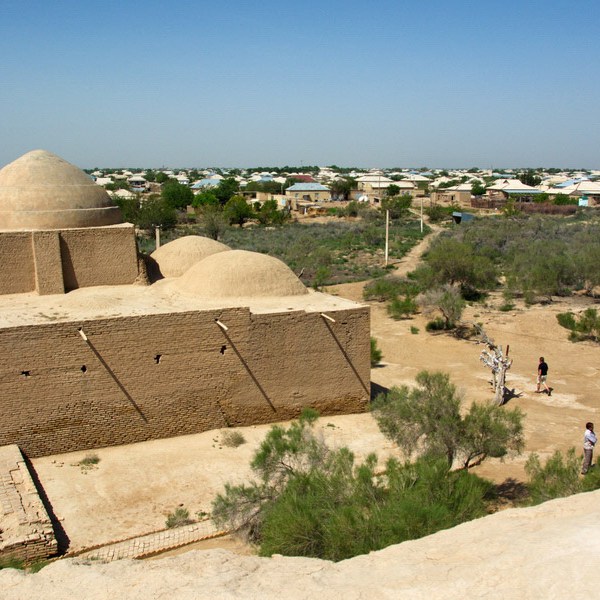
It is a set of mausoleums of the Askhabes, the « companions in arms » of the Prophet Mohammed: Bureyda ibn Al-Khuseyb Al-Aslami and Al-Khakim ibn Amr Al-Guifari. After the death of the Askhabes their tombs became local shrines. In the 15th century the Timurids built the religious complex around them. The black marble tombs are adorned with elaborate carving with vegetal ornaments and inscriptions. They dominate each other in the center of the mausoleum. Behind the tombs there are two restored aiwans. They are located side by side and they are oriented strictly to the south. From the photos of the end of the 19th century we can see that their initial height consisted of 12 meters, they were decorated with light blue and turquoise decorated tiles. In the middle of the back wall of the mausoleum the word « ALLAH » is written in Kufic characters, but on the side walls, diagonally, are placed some squares. The tombs still serve as a place of pilgrimage. That is why recently near the aiwans were added the places for the reception of the pilgrims, the places for the preparation of food and the covered cistern for the supply of water.
Bayramalikhan-Kala
One of the sights of New Merv is Bayramalikhan-Kala. The fortress was built in the form of a three-wall construction and is attached to the western wall of the Abdullakhan-Kala fortress. The length of the western wall of Bayramalikhan-Kala almost aligned at 750 meters, and the length of the northern and southern walls aligned at 500 meters. So far, small fragments of the southern wall and the northern wall have partially survived. The exact date of the construction of the fortress is not fixed, its name comes from the name of the regent Bayramali-khan (1781-1784) who won great love from the people.
The town of Durnali
The city Durnali is located 25 km from the fortress Gyaur-Kala. Numerous ruins of constructions of the IX-XII centuries have survived here. However, the city has older history. Once a large Parthian city surrounded by a mighty fortress stood here, a few years later it was restored. The fortress had a rectangular shape (about 180 х 160m). Powerful towers stood in the corners, as well as along the walls. The fortress was built to house within its walls the large number of townspeople: the number of loopholes reached five hundred, except for those who used the upper gallery, the battlements of the walls and the tower, behind which the enemy was attacked. The inner territory of the fortress is almost not built up. The ruins of some large building are kept near the center of the fortress. The walls of the fortress have been partially preserved. The coins found here, dated to the 1st-2nd centuries AD, bear witness to the age of Durnali.
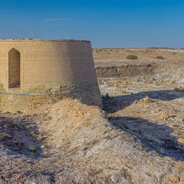
Erk-Kala
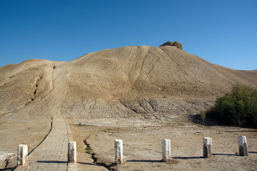

Erk-Kala was the old center of Merv. The ramparts of Erk-Kala have degraded around under the alluvial soil, but still kept the height and the power. By this fact, Erk-Kala stands out vividly among other fortresses. Now the height of the ramparts with steep slopes and neatly carved towers reaches 25-29 m. The surface of the fortress is 20 hectares. The fortress was round massive construction, at first sight without entrance. In fact, the only entrance settled here from the south side of the fortress. Inside the city dominate the remains of the palace of the regent. From the northern part of Erk-Kala was the municipal square (intended for the accumulation of the broad masses of the people). It is in particular Erk-Kala which once received the name of the city Margush.
The remains of the city Gebekli
The remains of the city Gebekli relate to the period of the existence of Parthia. They are 32 km from the Gyaur-Kala. This ancient small town was located next to the abandoned settlement of the ancient inhabitants of Margiana, behind the ramparts of Antiokh (Gyaur-Kala). Gebekli was surrounded by the square fortress-citadel with the only entrance. In the remains of the city were found fragments of pottery and jewellery, testifying to the developed craftsmanship of the city.
Gyaur-Kala

An ancient city Gyaour-Kala is the most powerful fortification work of antiquity, the surface of which is more than 300 hectares. The walls of the Gyaur-Kala are square, with the hills of the towers arranged on the identical distance from each other. The length of each wall is almost 2 km. In each wall there were doors. From the top you can clearly see the paths of the past, leading to four gates and dividing the city into four parts. The path from south to north goes directly from the southern gates to the ramparts of Erk-Kala, opening the way to the citadel, and extends around it on the side of the northern gates.
In the ruins of the city Gyaur-Kala there is the Antiochiya city of Margiana, built in the traditions of ancient architecture. The founder of the city is the king of the Selevkides Antioh Soter (280-261). Being in Margiana, he ordered to surround all oasis with a wall having in circumference about 230 km and to found the city of Antiokhiya. The Antiokhiya wall protected the lands of Merv from the desert sands and simultaneously played the role of the barrier border against the nomads. Its traces have remained until now north of the oasis of Mary.
The Kharam-Keshk castle

Kharam-Keshk is the separate castle of the peasant’s property next to Gyaur-Kala. There was a living area in the period from the 9th century until the 13th century. In the castle, built from raw brick, the half-filled ground floor and the rests of the first floor, with embossed walls, have remained. In the center of the castle there is a large square hall blocked by the dome. The other rooms of the castle connected with this room.
Large and Small Kyz-Kala


Traveling through the Oasis of Mary, one often sees the silhouettes of mounds-fortresses that have swum around under the influence of time. These are many properties-keshki of medieval feudal lords. The largest of them are Large and Small Kyz-Kala. Now they are historical monuments. Large and Small Kyz-Kala are small fortresses with embossed walls, as if folded, on the same principle as the accordion. They are placed on soft ground slopes with easy inclination. Small windows are hidden in the folds of the walls. At the top, the walls end in the toothed loopholes, which are almost not kept. The rooms on the ground floor were lit by five windows. The stairway leading down passed through an arched hallway. One can only imagine the planning of the first floor by the fragments kept. The first floor had at least five rooms arranged around the courtyard. Small Kyz-Kala is located about one hundred meters south of Large Kyz-Kala, it is built according to the same plan, but has been preserved in worse condition. The embossed facade remained only on the southern and east parts of a building.
Mausoleum of Mohammad ibn-Zeyd

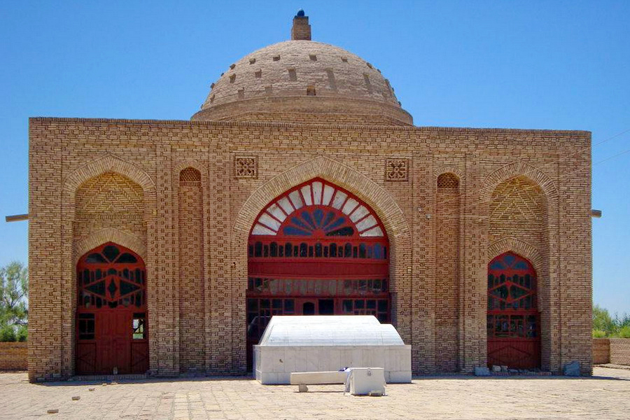
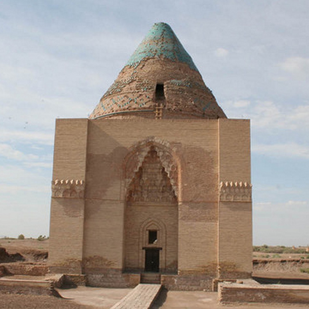
The Mausoleum of Mohammad ibn-Zeyd is the prominent monument of Sultan-Kala. It is small by measurements, but inspires admiration by its architectural idea. Inside the mausoleum there is a unique mural inscription in the Arabic language. The skillfully turned letters of fired brick, appear in relief against the background of the vegetal design, made of plaster. Its decipherment announces that the mausoleum was erected above the tomb of the Shiite representative of the Islam religion, Mohammed ibn Zeyd, the descendant of Caliph Ali in the fifth generation (1112-1113).
Being the descendant of the family of the prophet, and therefore the candidate for the imamate, Mohammed ibn-Zeyd presided over the insurrection against the Arab Umayyad caliphs in the 8th century of our era. The gathered Shiites recognized in ibn-Zeyd the imam, but in ten months it was repressed cruelly, Mohammad ibn-Zeyd died. His body was crucified on the cross at Kufa, but the head was cut off and sent to the Caliph in Damascus. At first the mausoleum appeared a small tomb where the head of ibn-Zeyd was located, but gradually it grew to this magnificent architectural complex which is now known in the Muslim world as the mausoleum of Mohammad ibn-Zeyd . The mausoleum is crowned by domes, one of which is higher and graduated than the others. The architectural style of the 12th century monument. delights with its harmony and simplicity.
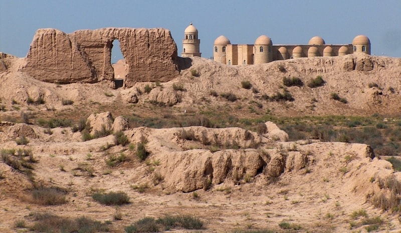
Sultan-Kala


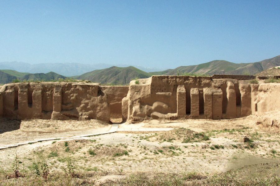
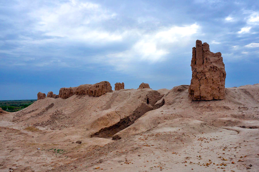
In the XI-XII centuries Merv became the capital of the Great Seljuk State and achieved the highest development. By order of Sultan of the Seljuks Melik-Shah the city was surrounded by the extensive rampart and moat. This fortress, whose surface is more than 400 hectares, is known, under the name – Sultan-Kala – « the Fortress of the sultans ». In the northeast part of the fortress Sultan-Kala the citadel – Shahriar-ark was erected, where the complex of palaces of the sultans, buildings of administrative purpose and military barracks were located.
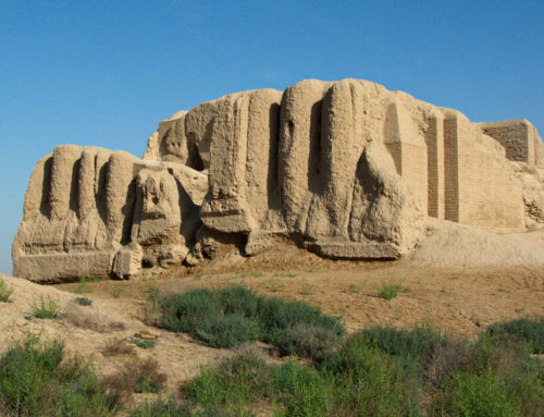
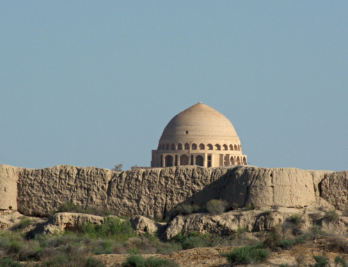
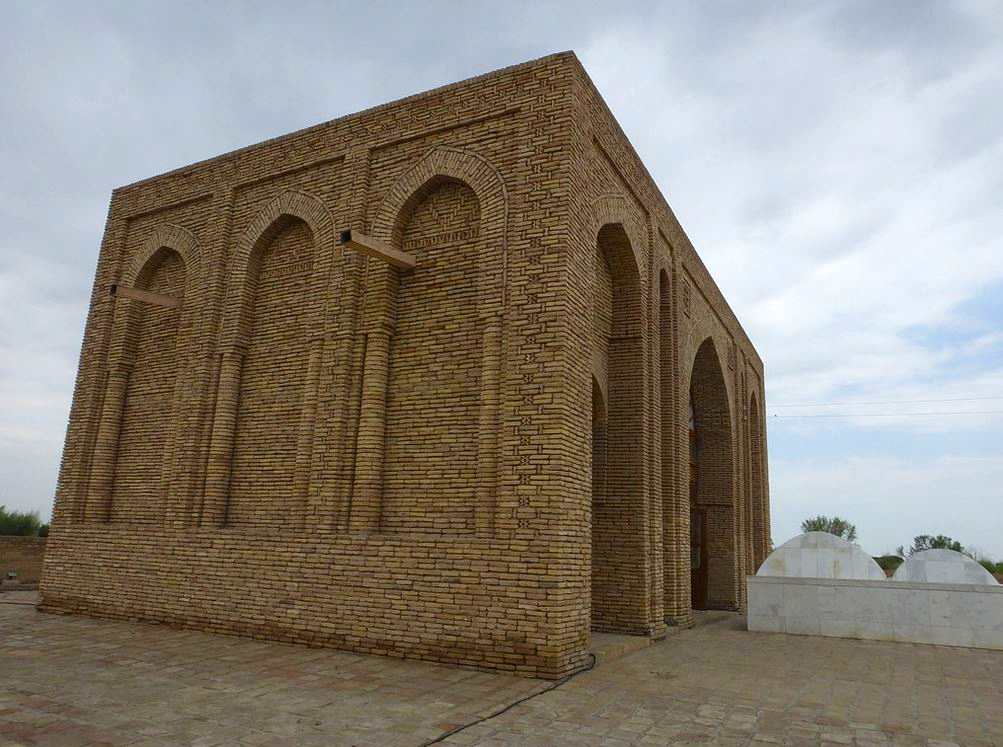
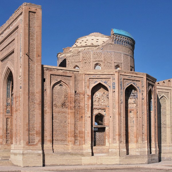
Mausoleum of Sultan Sanjar

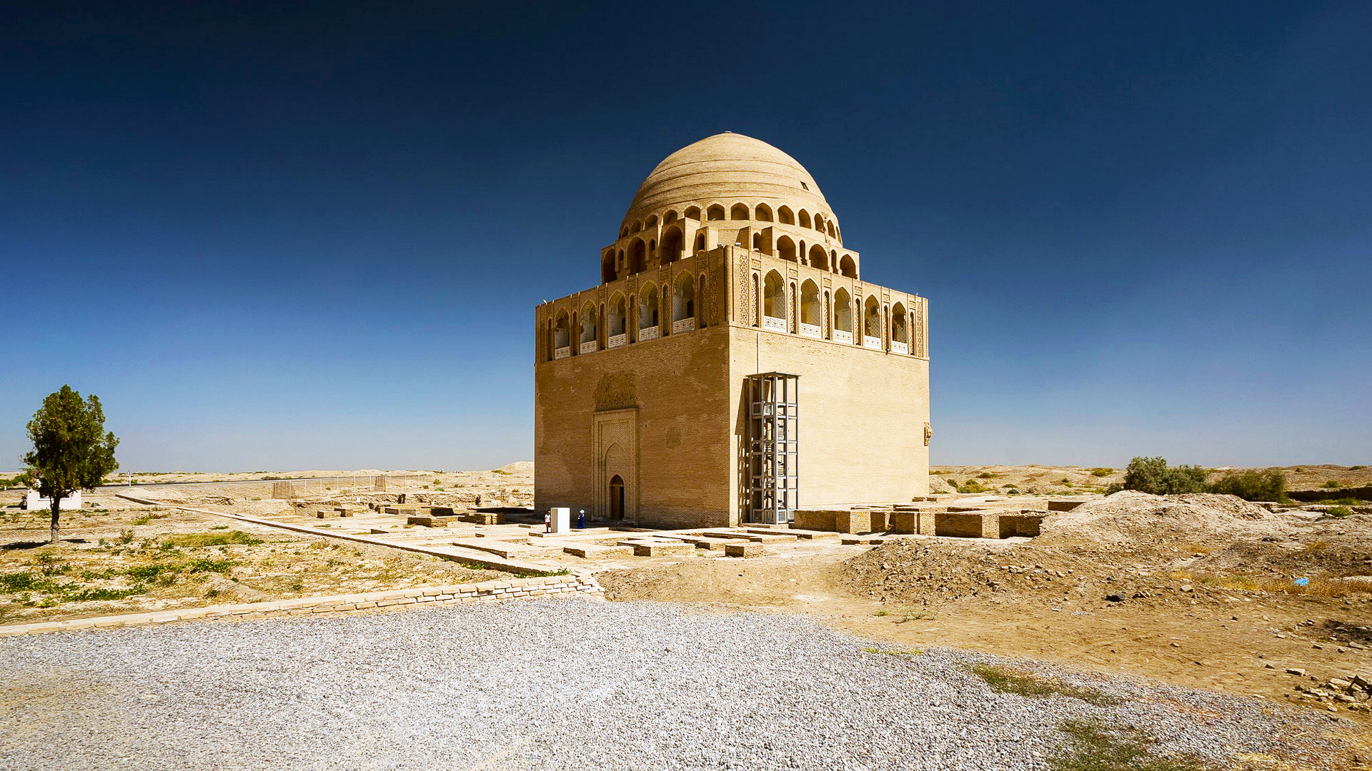

The most majestic architectural monument in Merv is the mausoleum of Sultan Sanjar known as « Dar-al-Akhire » (« Other World »). In all its aspect it reflects the blossoming of the power of the Seljuks. The mausoleum of Sultan Sanjar is located in the center of the city Sultan-Kala. Nearby there are large monumental buildings. These are the palaces of the regents of the Seljuk dynasty and the mosque. The Mausoleum of Sultan Sanjar is a real medieval skyscraper, cubic in shape, crowned by a double dome with a turquoise coating. Under the dome pass the triple galleries, in the form of openwork alternating arches. The dome symbolically signified the vault of heaven and it seemed « hovering » in the air. Surprising harmony and symmetry of proportions delight in the architecture of the Mausoleum of Sultan Sanjar. The walls are 5 m thick. and the length of 27 meters. The total height of the mausoleum is 38 m. The mausoleum was built by order of Sultan Muizeddin Sanjar. In 1157 he was buried. However, in 1221, when the Mongol troops took the city of Merv, the sultan’s dust was reburied, and furthermore, the place and time remained unknown. Thus, below the funeral slab of the mausoleum there was an emptiness. Until now the Arabic inscription on its facade announces: “This place is ennobled by the remains of the one who was called Sultan Sanjar, descendants of the Turks-Seljuks… He was just, like Alexander the Great. He was the protector of scholars and poets. He was accepted into the world of Islam in a state of prosperity and happiness through science and art. The mausoleum serves as a place of pilgrimage of thousands of believers, not to mention that it is the main object of attraction for foreign tourists.
The Talhatan Baba mosque
30 km from Old Merv there is a medieval village Talhatan. On the local cemetery in the Middle Ages the Talhatan-baba mosque was built. The mosque is depicted as the top rectangle. There are no traditional eaves or columns. A main facade is designated at once by three arches. The central arc is the widest. It corresponds to the central section of the building. Thus, the mosque is divided into three sections by the arches. The balance and harmony is reinforced by the brilliant ornamentation of the walls and the homogeneity of the exterior and interior decoration with the application of baked brick.
Yusuf Khamadani mosque


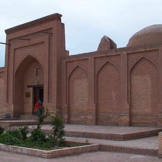
This set appeared on the place of the burial of the dervish Abu-Yakub Yusuf ibn Ayyuba, born in the city of Khamadane (Western Iran). Over his grave a mausoleum was erected, of which virtually nothing remains today. The building destroyed in the 19th century has been partially restored. The tomb of the dervish is symbolized by the crypt of black marble, adorned with flower ornament and inscriptions. In the western corner of the mausoleum is located the temple with central aiwan. It is the main part of the whole. Today the Yusuf Khamadani Mosque is an important Muslim temple and place of pilgrimage for believers.
Dashoguz and Konya-Urgench

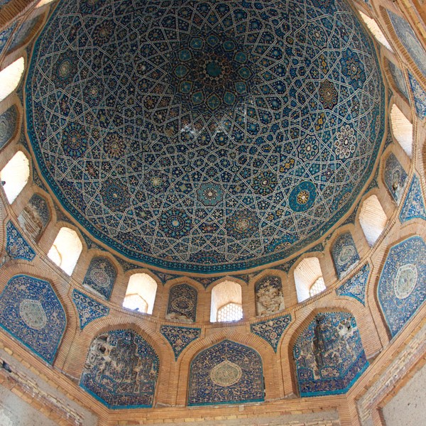
This city is located in the northern part of Turkmenistan. On the territory of Dashoguz region is located the capital of ancient Khorezm – the city Konya-Urgench, one of the strongest medieval empires in Central Asia. Since 995, when Gourgandj was the capital of the Khorezmshah state and was second in value and importance after Bukhara, the diamond crown of the Samanid dynasty, this city has preserved magnificent architectural monuments to the present day. These are the mausoleum of Arslan II and that of Khorezmshah Tekesh, dated from the 12th century. Particularly significant monuments of Konya-Urgench which relate to the XIV century, are the Turabek-Khanym mausoleum with the mosaic panel on the inner side of the dome, which presents the masterpiece of oriental art not having analogues in all medieval architecture, as well as the grandiose 60-meter Kutlug-Timur minaret, the tallest in Central Asia. In addition, here there are majestic ancient city-fortresses like Devkesen, Shasenem, Zmukshir, Kenevas and many others.


You can also visit the remains of the city Dashkala, the madrassah Dash-Mechet, the mausoleum of Il-Arslan, the Izmoukshir monument, the minaret of Kutlug-Timur, the minaret Mamun, the mausoleum of Najmetdin Kubra, the mausoleum of khorezmshah Tekeshe and the Turabek-khanum mausoleum.
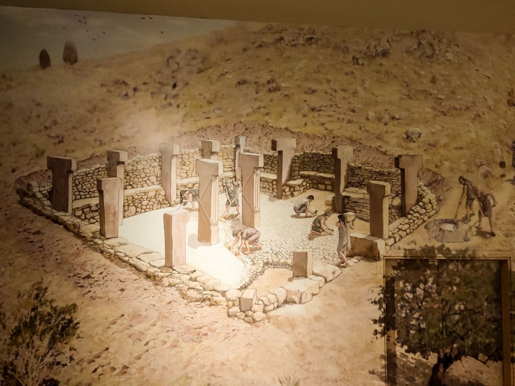
Gonur Depe
Not so long ago, in the 90s of the past century, in the middle of the sands of the eastern Karakum desert, archaeological scientists discovered at the Oasis of Mary a huge necropolis dating from III – II millennia before our time. There was once a capital, now called Gonur Depe (translated from Turkmen as « gray hill ») with its palace and few temples that could rival those of Assyria and Babylon.
The excavations of this place have led scientists and historians to amazing discoveries. The temple city has held its mysteries in the desert sands for many thousands of years. It is assumed that Gonur Depe was the largest city in all of Margiana. It was located on a small hill on the right bank of the Murgab River. Excavations continue until now and archaeologists still do not know the extent of the area. Preliminary data indicate that the area of the ancient city varies between 30 and 50 hectares. This supposed « capital » did not have a ruler with definite authorities, ruling the entire country, but rather a spiritual leader – a supreme priest. People respected him without compulsion and only willingly, moved by faith.
Darwaza – gas crater
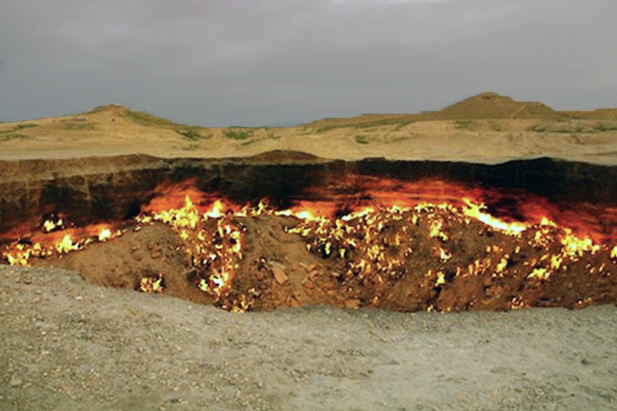
Pictures and videos with the mysterious name « The Gates of Hell » enjoy great popularity on the Internet. In these photos we see how the fire rejects the earth in the middle of the desert. The sight of the burning flame among the yellow desert sands bewitches and intrigues expert travelers. But few people know how, in particular, this miracle of nature arose, located 266 km north of the city of Ashgabat.
In 1971 in the Kara-Kum desert not far from the small village Darwaza whose name in translation from the Turkmen language means « doors », an exploratory gas hole was drilled. During the drilling an incident took place: geologists accidentally discovered an underground cavern in which fell all the equipment with a headframe for drilling and transport. People did not suffer, but natural gas escaped from the cave. To avoid problems with local inhabitants of the Darwaza village, the geologists took the decision to light the gas hoping that it would completely burn out in a few days. Weeks, months and years passed but the fire burned constantly. In 2004 at the order of Turkmenbashi the Darwaza village was moved to another place but the crater continued to burn. It burns and today. No one knows how long this will last. Finally, it is possible that gas resources will run out or the pit will be filled. Yet the Darwaza gas crater remains one of the most interesting and mysterious sights in Turkmenistan attracting a large number of tourists every year.
If you come to « the gates of hell » during the day you see a hole in the ground that does not deserve any interest. As you approach closer you see thousands of tongues of fire blazing in the 20 meter crater. The gas escapes to the surface and ignites, heating the air. If you visit this sight in the evening it is possible to enjoy a charming spectacle against the backdrop of the setting sun. Around the crater there are still some potholes, one of which is full of turquoise liquid. It is better to see potholes before dark with caution: they crumble to the edge. You can also smell the high air temperature and the smell of natural gas. The Darwaza gas crater differs greatly from other natural sights around the world in its sense of calmness and uniqueness. Here there are no paid parking lots, pedestrian paths, palisades and shops with souvenirs. The desert around and there is nobody.
The nearest cafe where you can have lunch is a few kilometers south of the crater. Shops can be found in the village Erbente which is located 90 km from the crater. Going towards the gas crater it should be taken into account that a few hundred meters pass on the sandy path which can be crossed by all-terrain vehicle.
